
Hiking Trail: The Marcelly Loop


1 / 4
Intermediate
4h
8.5km
Loop
+610m
-610m
Description
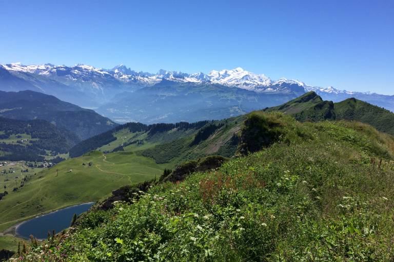
A mid-mountain trail, part of which runs along ridges, offering remarkable views of Lake Roy, the alpine pastures, the Mont Blanc massif, and the peaks of the Chablais.
The area around Lake Roy—a natural glacial lake—and the Gron alpine pasture are a paradise for marmots and chamois. Of course, the cows also enjoy the beauty of these surroundings during the summer grazing season. From the ridge, the view opens up onto the Giffre Valley, Le Môle, and the Aravis Mountains. The 360° panorama from the Pic de Marcelly is magnificent.
Pricing
Free access.
Route GPX track
Parking des Molliettes, Praz de Lys, 74440, Taninges
Molliettes Parking Lot, located on the Col de la Ramaz Road (D308), just outside Praz de Lys.
From 15/05 to 15/11 daily.
Subject to favorable snow and weather conditions.
Subject to favorable weather, Subject to snow conditions